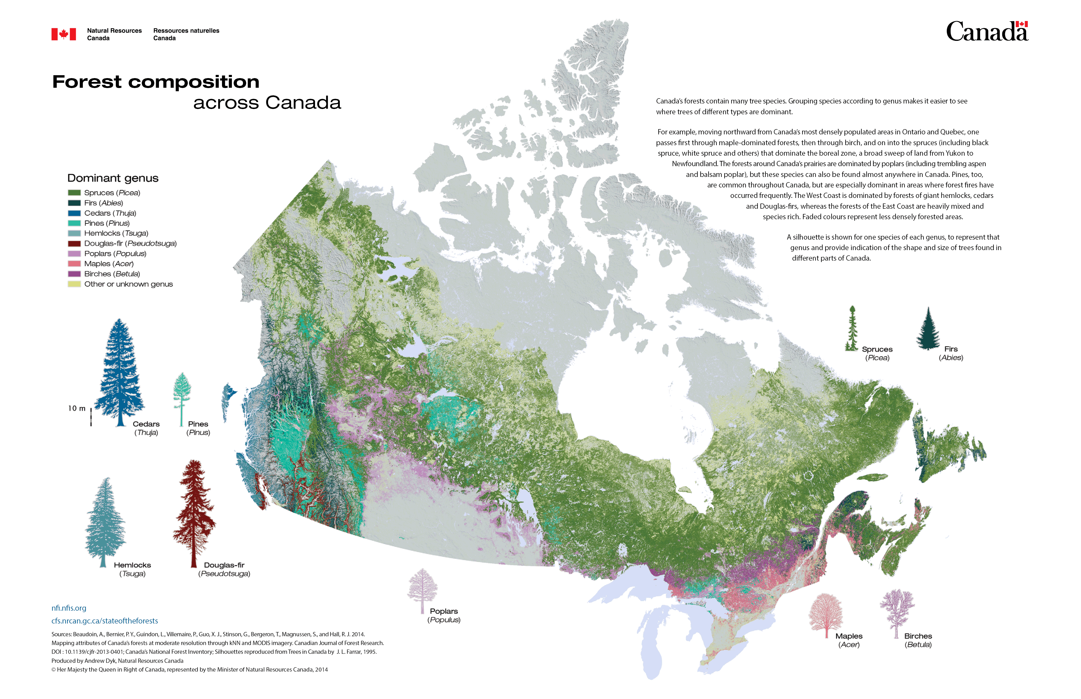
The raster maps depict a suite of forest attributes in 2001* and 2011 at 250 m by 250 m spatial resolution. The maps were produced using the k nearest neighbours method applied to MODIS imagery and trained from National Forest Inventory photo plot data. For detailed information about map production methods please refer to Beaudoin et al. (2018) "Tracking forest attributes across Canada between 2001 and 2011 using the k nearest neighbours mapping approach applied to MODIS imagery." Canadian Journal of Forest Research 48, 85-93. https://cfs.nrcan.gc.ca/publications?id=38979
The map datasets may be downloaded from https://nfi.nfis.org/downloads/nfi_knn2011.zip or open.canada.ca
* Note: the forest composition (leading tree genus) map depicts forest attributes in 2001.